 Projections Find System
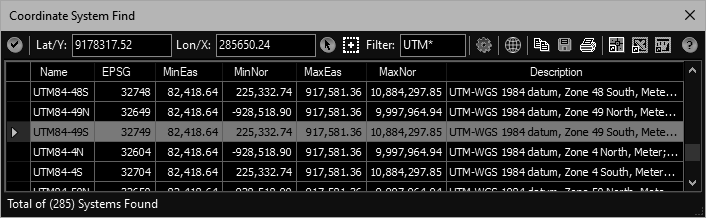
Helps determine a drawings coordinate system by finding those bounding a selected point.
After results grid is populated, this tool can create a KML file (opened in Google Earth) containing labeled placemarks of the coordinate in the resulting systems. This allows the user to zoom/pan to the known location on the planet and determine the appropriate system.
Keyboard Command: PrjFndSys
Procedure:
- Open the drawing you wish to determine the system of.
- Initiate the tool using the menu, ribbon, or command above.
- Enter the coordinates to find or use the adjacent pick buttons.
- Optionally filter the names found with condition like UTM*.
- Click the button to begin searching for results, wait for completion.
- Optionally click the button, creating a KML file to search (see notes).
- Review the systems found. If a system qualifies, select the row and click the button.
Notes:
- The KML file option can be very useful. Assuming your drawing was on a proper coordinate system, zooming and panning to the known location in Google Earth can allow you to quickly locate the proper system visually!