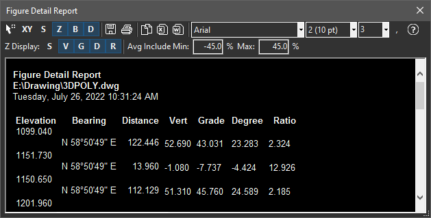
Displays coordinates, direction/distance and curve details with summary information on a selected figure. For 3D figures, optionally include slope distance, grades, etc.
Keyboard Command: FigDetRep

Procedure:
- Open or create the drawing containing the figures to inquire.
- Initiate this tool from the ribbon, menu or command above.
- Click the button in the upper left.
- Optionally change options such as font details and/or print.
Notes:
- Clicking the button includes the northing and easting coordinates in the report.
- Clicking the button includes the elevation and other elevation related parameters.
- Click to press the buttons to toggle fields for slope distance, vertical distance, grade(%), degrees, or ratio information.
- At the end of the report, a weighted average of the designated fields will be reported. Normally these numbers reflect all segments of the figure. If you wish to throw out extreme segments, you can specify a minimum and/or maximum value to consider. This does not factor in segments outside this range.
 Figure Detailed Report