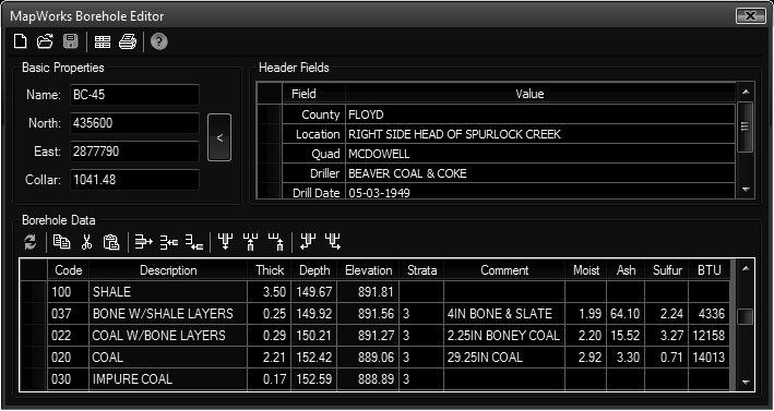
Create new boreholes in the drawing or edits and existing borehole. Before creating boreholes you may wish to set a Strata Table current in MapWorks Settings and/or edit the Strata Table.
Keyboard Command: GeoBorEdt

- New: Immediately clears the editor and sets up for entry of a new borehole.
- Open: Immediately replaces the current contents of the editor with the selected file.
- Save: Saves the contents of the editor to a file.
- Default: Sets the current layout (fields & columns) as the default for new boreholes.
- Print: Initializes the Print function with its own controls and preview.
- Cut: Cuts the selected data from the grid, moving it to the clipboard.
- Copy: Copies the selected data to the clipboard.
- Paste: Pastes the contents of the clipboard to the grid.
- Row:
- Delete: Deletes the currently selected row.
- Insert: Inserts a row at the current position. If you are on the header tab, you will be prompted for the field name.
- Add: Adds a new row at the bottom. If you are on the header tab, you will be prompted for the field name.
- Help: Displays the help file.
New Borehole Creation:
- Enter all values in the Basic Properties section.
- Optionally enter additional information in the Header Fields section.
- Enter the borehole data in the spreadsheet.
- Save the borehole at any time with the Save button.
Existing Borehole Edit:
- Click the Open button and select a borehole in the drawing.
- Make changes as desired.
- Save the borehole at any time with the Save button.
Notes:
- The first time a borehole is saved a symbol will appear in the drawing at the coordinates entered. Further saves will modify the extended data on that existing symbol. All data is stored in the drawing.
- Code, Description, Thick, Depth, and Elevation fields must exist and be the first columns in the data section.
 Borehole Editor