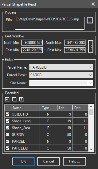
Reads an ESRI Shapefile (Type Polygon) and creates parcels inside the current drawing with extended properties obtained from the Shapefile data file (.DBF).
Keyboard Command: ParShpRed

Procedure:
- Open or create a drawing to import the content into.
- Initiate this tool from the menu, ribbon or command above.
- Click the button to select a Shapefile.
- Optionally specify a coordinate limiting window or pick one with the button.
- Choose a database field from the dropdown for the parcel name.
- Optionally change other options including toggling which fields to import as extended properties.
- Click to begin processing the Shapefile content.
Notes:
- You must select a field from the dropdown for the parcel name, other fields are optional.
- In Civil3D, you must designate a value for the Site Name. If the site does not exist, it will be created.
 Parcel ShapeFile Read