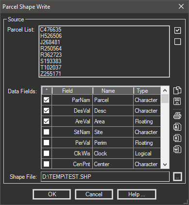
Writes parcel information (included extended properties) to an ESRI Shapefile.
Keyboard Command: ParShpWrt

Procedure:
- Open the drawing containing the parcels to export.
- Initiate this tool from the menu, ribbon or command above.
- Optionally deselect parcels in the list at the top.
- Click the button to select a Shapefile.
- Choose a database field from the dropdown for the parcel name.
- Optionally change other options including toggling which fields to import as extended properties.
- Click to begin.
Notes:
- You must select a field from the dropdown for the parcel name, other fields are optional.
- Due to a problem created in Civil3D 2020 (Reported 2020-07-15), we are unable to automatically load the content. After closing this dialog use the Civil3D 'Import LandXML' dialog to load it. When specifying the file name to load, use Shift+Ins or Ctrl+V to paste the file name the tool placed in the clipboard.
 Parcel ShapeFile Write