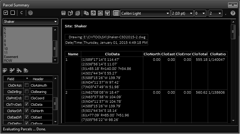
The parcel summary is used to generate a consolidated report of multiple parcels.
Keyboard Command: ParSumRep

Procedure:
- Optionally change the selected parcels to report (default is all).
- Toggle the desired fields in the grid in the lower left.
- Optionally print or export the report.
Notes:
- In the field grid you can control the order of the columns. Select a grid row and use the toolbar buttons to move the column in the list.
- You can change the header value displayed by editing the value in the grid.
- Changes to the order and header strings are saved for future sessions.
- If using closure fields:
- The results are calculated by generating mapcheck bearings and distances, then traversing the strings to check closure.
- In the case of curves the chord bearing and distance is used to continue the traverse.
- You can change the bearing/distance precision at the top. After changes in these drop-downs, use the adjacent icon to regenerate the report.
- When using Civil3D 2022 or prior, the "Address" and "TaxID" fields cannot be extracted. These will appear properly in Civil3D 2023 and higher.
 Parcel Summary