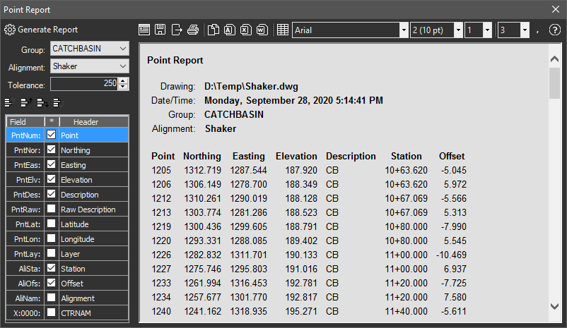
Generates detailed point reports with user controlled columns.
Keyboard Command: PntInqRep

Procedure:
- Designate the points to process with available methods.
- Click the button to generate the report.
- Optionally use report methods to print or export the report.
Notes:
- For PntLat/PntLng fields to work, the current drawing must be assigned a known coordinate system. The latitude and longitude values displayed are WGS84 (EPSG:4326).
- Since the extra columns of extended point data can vary with each file (or point group), those columns are not stored for subsequent sessions.
- A Report Header Content button lets you change the displayed header from "Point Report" as shown above.
- You can Save the contents of the entire report to HTML, or Export the contents of the primary table to CSV, DBF, XML, etc.
 Point Report