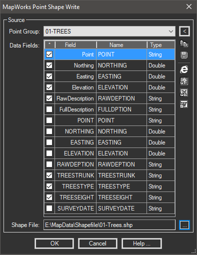
Creates point based shapefiles from drawing points or standard coordinate files.
Keyboard Command: PntShpWrt

Procedure:
- Designate the source type (points or file).
- Select the points or source file using the adjacent icons.
- Choose the Process button to fill the grid with resulting point information.
- Designate the database (DBF file) output fields and field names.
- Click the button to designate an output (SHP) file.
- Choose to create the shapefile.
Notes:
- Depending on the desired results, the Northing/Easting fields may be excluded.
- Field names for the resulting DBF database file must be 10 characters or less.
- Per the ESRI Shapefile Technical Description, "All filenames adhere to 8.3 naming convention".
- If the source option is drawing points and the current drawing has a coordinate system assigned, a corresponding PRJ file will be created.
 Point Shapefile Write