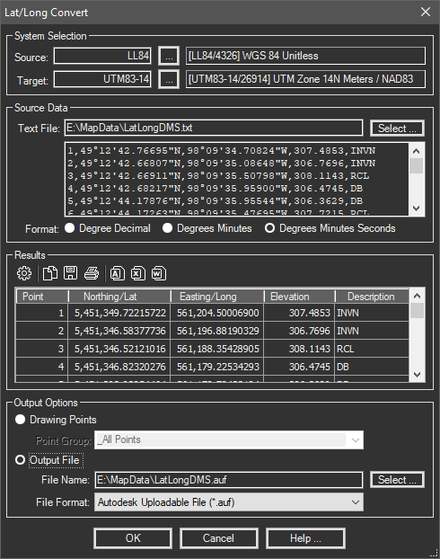
Reads a text file containing lat/long coordinates (in Degree Decimal or Degrees Minutes Seconds) and projects the values to a selected system. The results can be written to any supported point format.
Keyboard Command: PrjCnvLlc

Procedure:
- Enter or pick a source and target system.
- Click the button in the Source area and choose the text file containing the points.
- Check the radio button for the format to use (see note).
- Click the button in the Results area to convert the coordinates.
- Choose the output option desired (drawing points or output file).
- Choose the button to create the export file.
Notes:
- The source data currently expects point, latitude, longitude, elevation and description fields in that order.
- If the Degrees Minutes option is chosen, the lat/long fields are expected to be in DD.MMMMMM format. The degrees is left of the decimal, the whole portion of minutes is the first two characters after the decimal, and all remaining numbers are precision of the minutes. In other words 12.34567 is interpreted as 12°34.567'. If the number of minutes is less than 10, it must be preceded by a 0, as in 12.05123 which is 12°5.123'.
 Convert Lat/Long