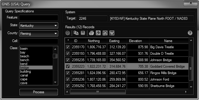
This tool uses an Internet connection to query the Geographic Names Information System based on specifications you provide. It then parses the results, projects the returned latitudes & longitudes to the current drawings system and gives you the ability to plot the data (as blocks & points).
Keyboard Command: PrjGnsQue

Procedure:
- Open the drawing you would like to plot in.
- Optionally load any block definitions needed.
- Assign a coordinate system to the drawing.
- Initiate this tool from the menu/ribbon.
- Choose the state and county you are interested in.
- Optionally choose the classes you would like to return.
- Choose the to begin processing.
- Wait while the program collects the data from the GNIS site.
- Optionally choose further processing such as plotting or saving the data.
Notes:
- The program builds and submits a query string to the GNIS site. The amount of time it takes can vary significantly depending on the items chosen and the speed of your internet connection. Broad queries in populated areas could take time.
- When plotting the results, the tool looks for matching blocks in the current drawing. When a matching block definition name is not found, a point is used.
- The latitudes & longitudes returned by GNIS are NAD83.
- Click the following link for details on the GNIS system.
 GNIS Query