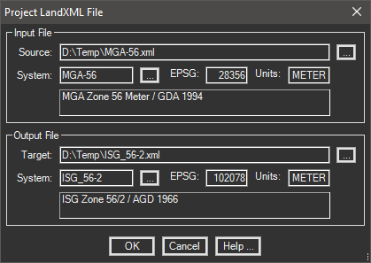
Projects a LandXML file to a new selected coordinate system.
Keyboard Command: PrjXmlFil

Procedure:
- Use the LandXML creation software to prepare the file in the source system.
- Initialize this tool from the menu, ribbon, or command above.
- Select the source and target coordinate systems.
- Select the source file using the select button .
- Confirm and revise the target tile in the output selection.
- Choose the button to begin processing.
Notes:
- Minor rounding differences can cause reading applications to flag some alignment curves as non-tangent. This may be a configurable tolerance in the reading application.
 Project LandXML File