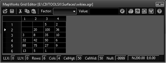
This tool allows opening, editing, and saving of a grid surface. The edit process is optional, you can use this tool to open a grid in one format and save it to another format for conversion.
Keyboard Command: SurGrdEdt

Procedure:
- Choose the button to load a grid file.
- Optionally change specifications and/or edit the node elevations.
- Optionally select a range in the spreadsheet and apply factors.
- Choose the button to save to a file.
Notes:
- Certain save formats (such as AGR/HDR) require the cell height and width to be equal. Attempting to save unevenly sized cells to these formats returns an error.
- To apply factors, first select a rectangular range of nodes you wish to apply the change to. To select all the cells click in the upper left corner.
- 1 foot = 12/39.37 meter.
 Surface Grid Editor