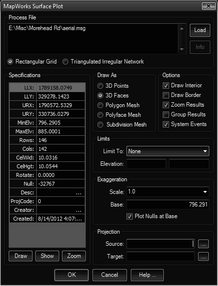
This tool plots a Grid or TIN file in the current drawing as points, lines, 3DFaces or a mesh. If multiple object results (such as points, lines, faces) it can bind these together in an CAD group making it easier to select later.
Keyboard Command: SurPltAll

Procedure:
- Open the drawing to place the surface in.
- Optionally establish a new layer and make it current.
- Initialize the tool.
- Choose the button to select a grid file.
- Designate desired output options.
- Choose the button to generate the results.
General Notes:
- Large surfaces may take time to process.
- Turning on the Group Results toggle on large files is not recommended.
- To plot the full elevation range, leave the Min/Max Elevation fields blank.
- Because this tool can be processor intensive, you may want to turn on the System Events toggle so the CAD engine can repaint windows, etc.
Mesh Notes:
- Subdivision Meshes are not available on AutoCAD 2007-2009.
- AutoCAD limits a Polymesh to roughly 32,767 vertices, so large grids may exceed this and this option will be grayed out.
- When the Polymesh option is taken, the Group Results option does not apply (it's a single object) and will be ignored.
 Surface File Plot