 Surface ShapeFile Read
Creates a surface based on the point contents of an ESRI ShapeFile. The ShapeFile type can be type 1 (points) or type 2 (polylines). The companion .DBF file is examined to supply the elevations of the features supplied in the .SHP file.
Keyboard Command: SurShpRed
Procedure:
- Open the drawing to generate the surface in.
- Assign a coordinate system to the drawing if not already done.
- Initiate this tool from the menu, ribbon or command above.
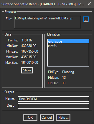
- Click the to select a ShapeFile to use.
- Optionally review (and show) the coordinate window data (left).
- Select the items in the Elevation panel to determine the elevations (see note).
- Choose the button to begin processing.
Notes:
- When selecting the elevation field, it may be helpful to view the type, length and decimals information that changes when each item is selected. You are looking for a Floating type (number) for the elevation.
- You can also use Excel to help review the values. Use its Open dialog and choose type (Dbase III *.DBF) to open the .DBF file. After determining the column, close the data table. Do not make changes and do not save.