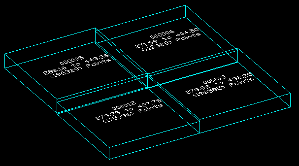
This tool can be used to quickly draw the 3D bounding box of a selection of files that contain header information (such as ESRI ShapeFiles and Lidar LAS Files). In these types of files, the extents of the file can be extracted very quickly without reading the entire file. The resulting rectangle can help determine where the contents would reside.
Keyboard Command: MapFilExt

Procedure:
- Initiate the tool.
- Select the files to process.
- Choose to begin.
- Zoom extents if necessary to see the newly created tiles.
Notes:
- The label shows the file's core name, on LAS files it shows elevation range and number of points.
- The cube is drawn as a LWPolyline with thickness to avoid ACIS solids (slowdown).
 Map File Extents