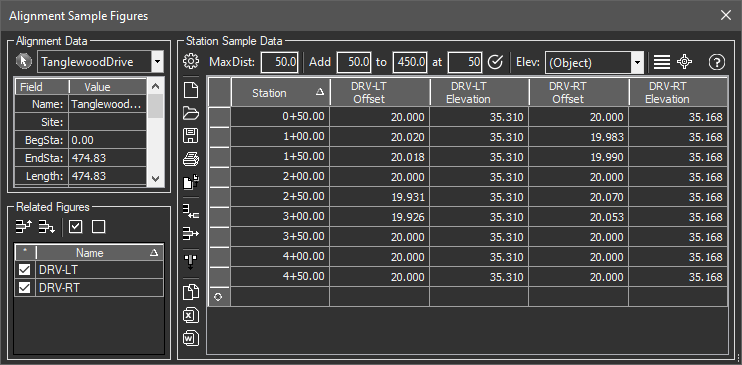
This tool scans left/right at specified stations for the intersection of relative figures. It can obtain the elevation from the object or sample a predefined surface at the location.
Keyboard Command: AliSmpFig

Procedure:
- Select an alignment from the list or use the arrow button to select one in the drawing.
- Manually add stations to sample or use the Add Range tool at the top.
- Optionally change the order of the named objects in the lower left.
- Click the Process Grid button to calculate the grid.
- Optionally save to a file, export to an application like Excel.
- Optionally draw sample lines or cogo points from the results.
Critical Notes:
- Drawing objects to be considered for inclusion:
- For Civil3D, they must be named FeatureLines that are assigned to the same site as the alignment.
- For MapWorks, they must be polylines with extended data added by the Tag Relatives tool.
Other Notes:
- The scanning looks for intersections within the distance value (upper left of the sample data area). The initial value is not a large number to avoid intersecting the same figure twice in near U shapes cases such as rural roads. If you have a situation where lanes split you may need to increase this value.
- You can use the Elev popdown to choose a predefined surface before processing.
 Alignment Sample Figures